

Cartographies of the Unseen
A Conversation with Forensic Architecture and LIMINAL
Forensic Architecture and LIMINAL use cartography, spatial analysis and forensic tools to reveal the structures of violence. A dialogue on emergencies, migration, Gaza and reconstruction, in which the map becomes a critical tool for interpreting space and challenging the way it is governed.
Testo in italiano al seguente link
The phrase «the map is not the territory», formulated by the linguist Alfred Korzybski,1 remains in the background of this conversation. A map never fully coincides with what it represents: it selects, excludes and shows what its maker decides to make visible. Korzybski suggests that it is another version of reality; and if it is a choice, then one can choose otherwise, one can map what others have erased. It is within this distance, between territory and its representation, that Forensic Architecture and LIMINAL operate: two research groups that use the tools of architecture, cartography, modelling and spatial analysis to make visible what often remains unseen.
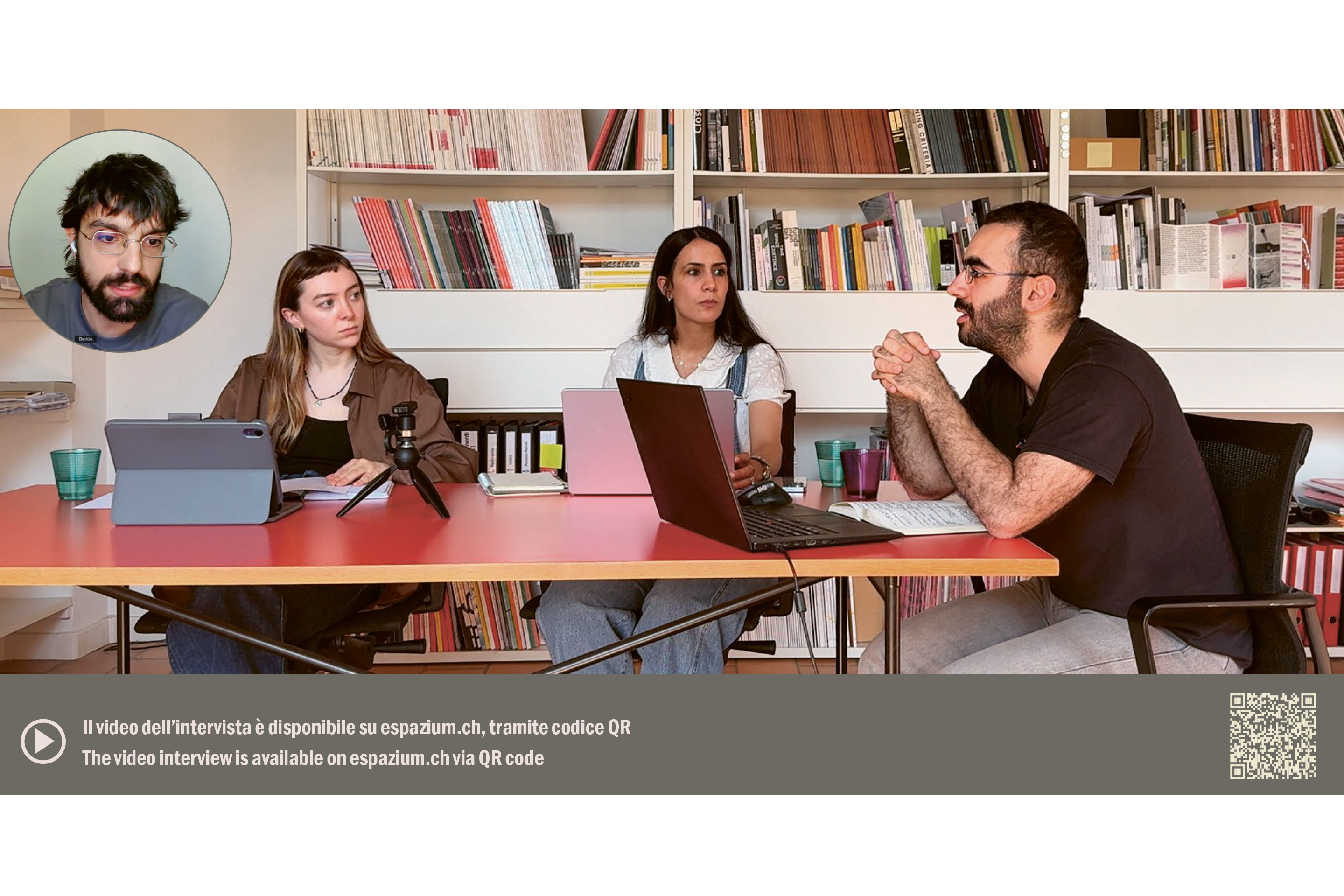
Forensic Architecture, a research agency based at Goldsmiths, University of London, uses the instruments of architecture to investigate human rights violations and war crimes: here represented by Davide Piscitelli, Advanced Researcher at the agency. LIMINAL, founded by Lorenzo Pezzani at the University of Bologna, investigates border violence and migration dynamics through the forensic imagination, in collaboration with human rights organisations and investigative journalists: it is represented in this conversation by researcher Tareq Tamimi. Also taking part is Hind Al-Shoubaki, architect, urbanist and researcher at FHNW, who is curating this issue for espazium quaderni.
When Emergency Becomes Structure
To think of emergency as temporary is, in part, an understandable reflex, a way of refusing the idea that violence might persist until it becomes structure. The hypothesis running through this issue, and guiding this dialogue, is instead that emergency can be a mode through which space is produced, administered and governed.
Within the framework outlined by Al-Shoubaki, emergency itself becomes architectural: it distributes vulnerability, produces evidence, regulates mobility and determines the terms of reconstruction.
For Piscitelli, the two temporalities coexist, and the critical event is often only the visible surface of a condition already in place. The very language of emergency carries the risk of treating crisis as something to be managed in the short term, without grasping its context. Against this compression, their work «seeks to impose a different temporality, not the compressed temporality of urgency, but the long temporality of the structural condition that led to the crisis». Taking up Piscitelli’s point, Tamimi shifts the focus to migration. The idea that migration is a permanent state of emergency may seem recent, tied to the so-called Arab Springs, but it is an imposed condition with colonial roots. Europe, which once had a physical presence in the countries from which these people now depart, exercises control at a distance, through policies that push the frontier outwards, to the point of «imposing borders even where, in theory, it has no authority».
When a situation conceived as temporary extends across generations, space begins to transform and to adapt to the needs of those who inhabit it. Spaces are made for people, and cities arise from the needs of those who live in them; for this reason, when thinking about before and after, the closest attention must be paid to the present.
The Tools of Investigation
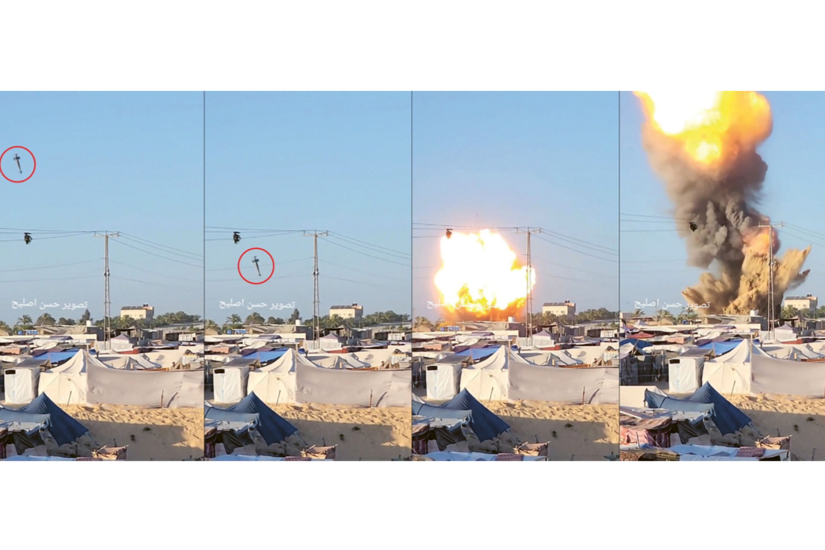
The method of the two collectives is similar in the tools it uses, which are predominantly digital. Forensic Architecture works through what it calls «counter-investigations»: images, videos and satellite footage brought into relation with situated testimonies, gathered within the very space of violence. When this condition becomes everyday, an excess of images no longer produces indignation but habituation; this is how an attack on a hospital almost ceases to be news. Within this accumulation of evidence, spatial tools become devices of orientation or, as Piscitelli puts it, «tools against the anaesthesia of violence».
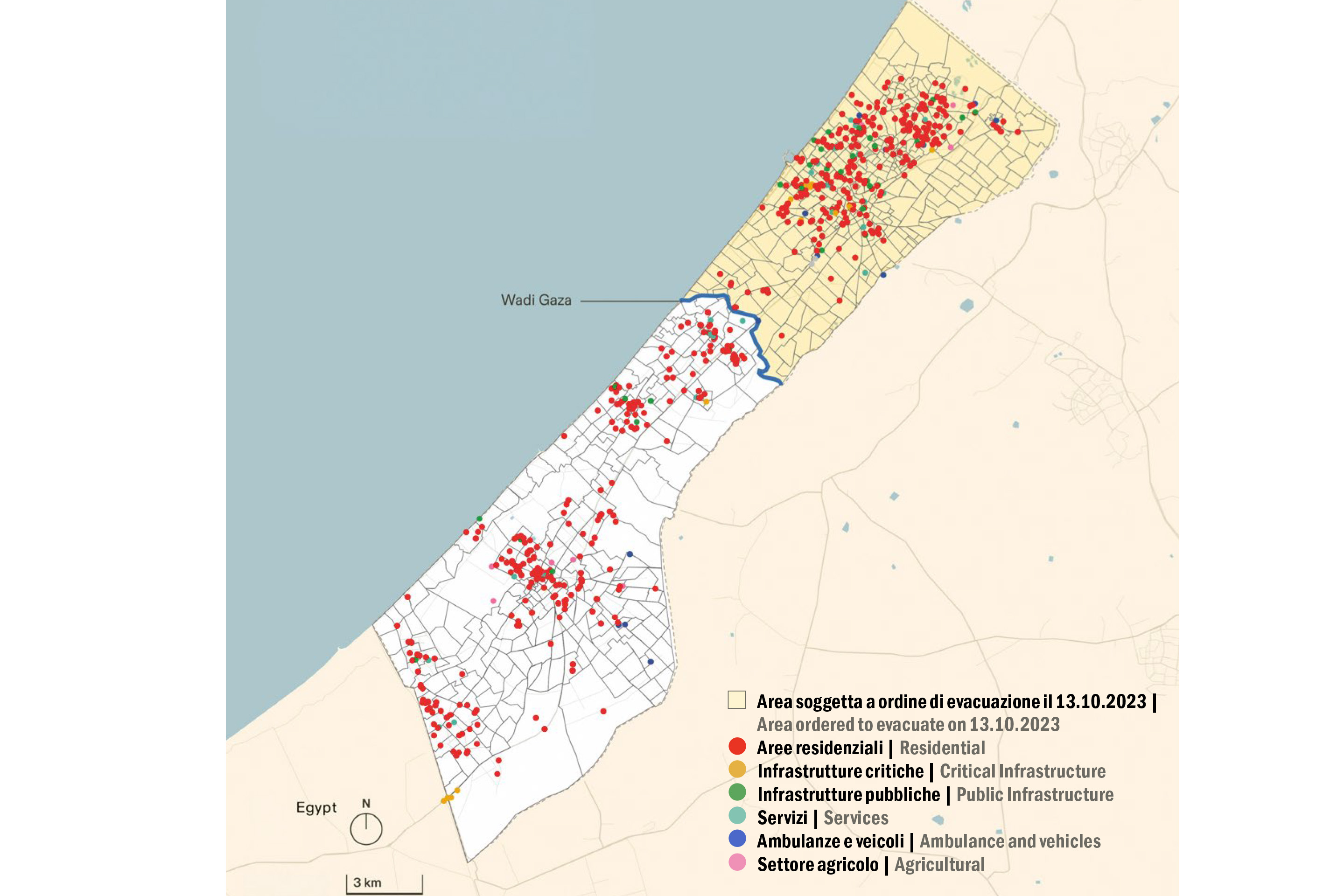
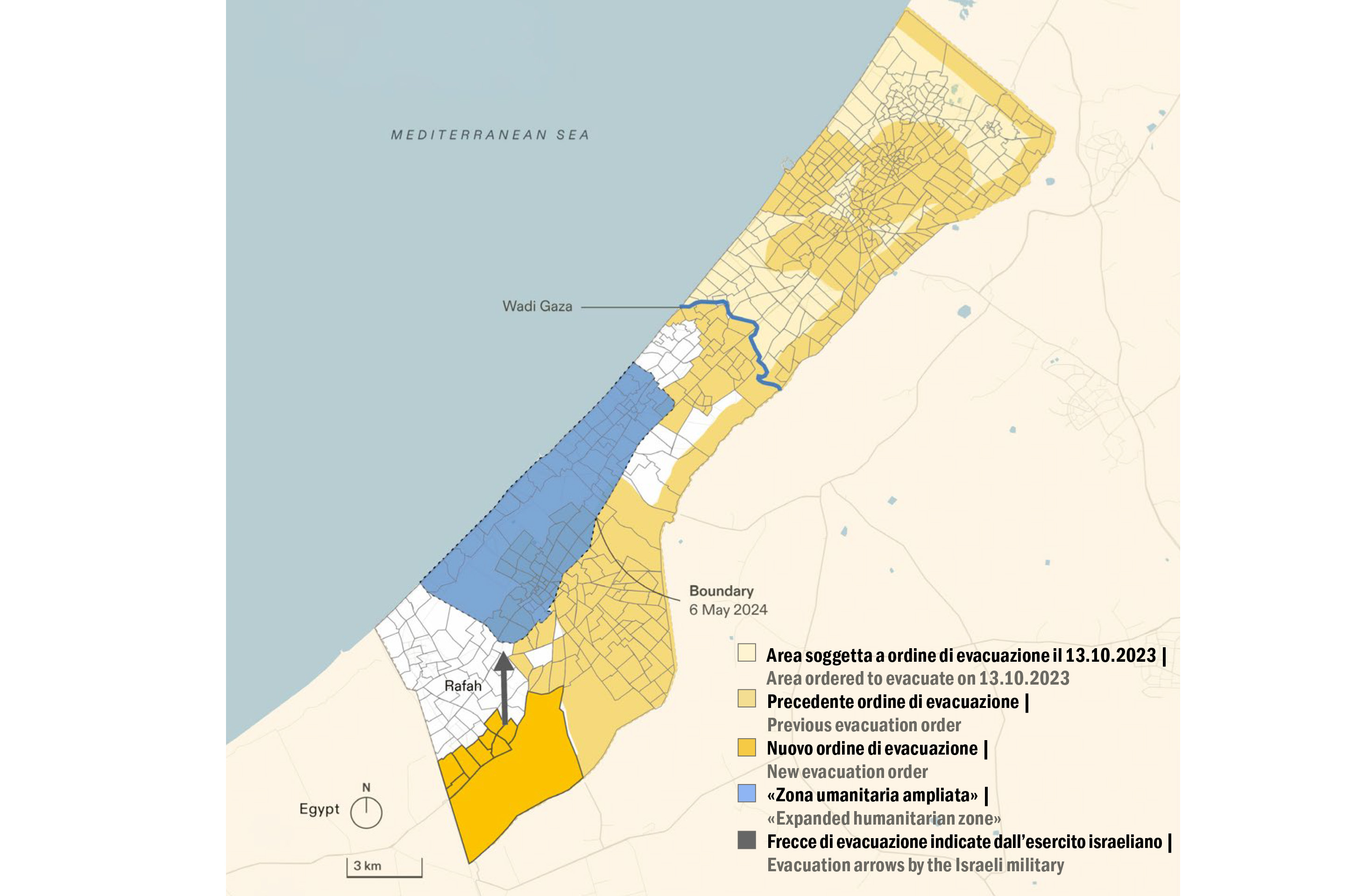
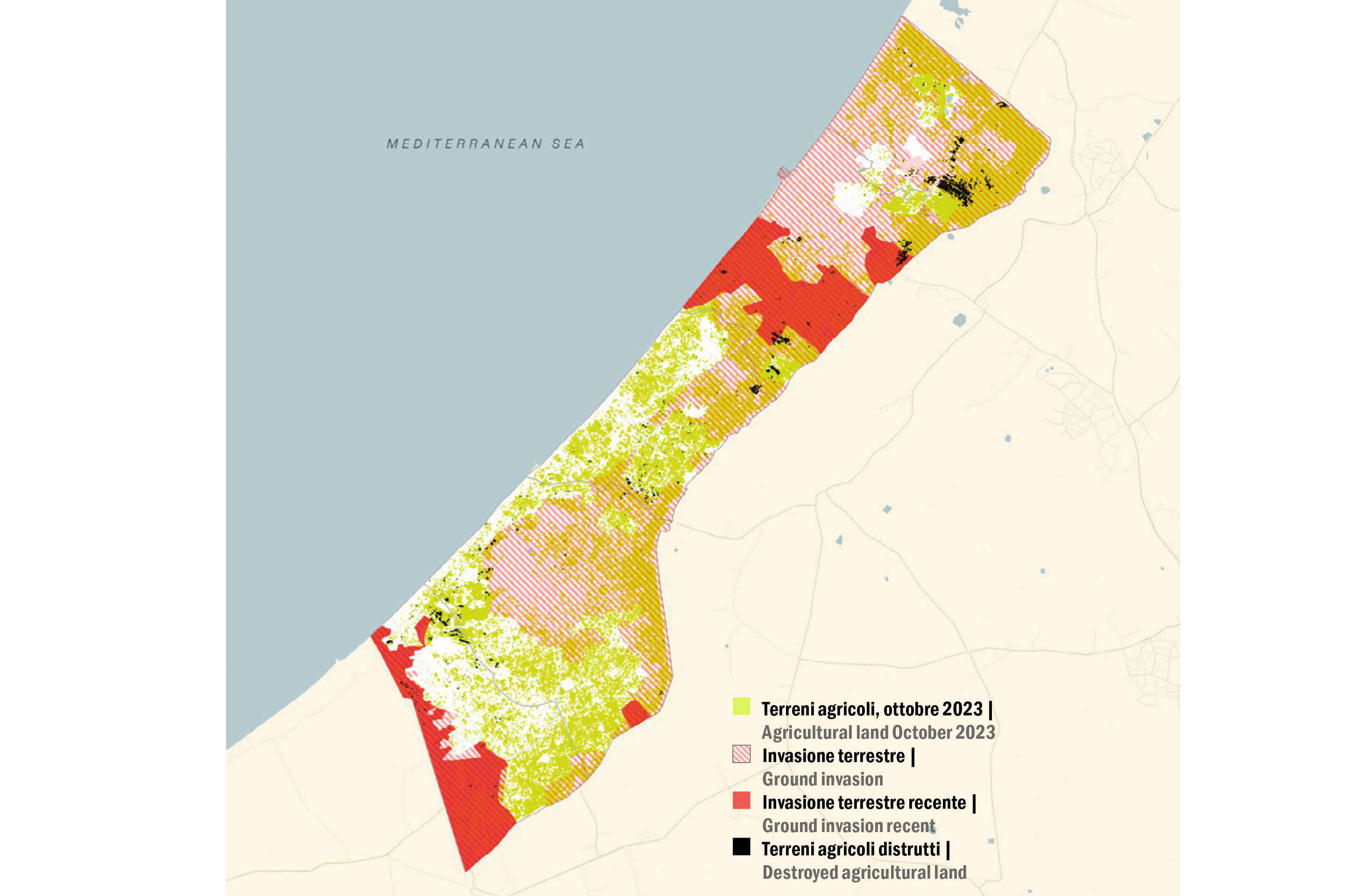
This is the principle behind A Cartography of Genocide, the interactive map on which Piscitelli has worked most extensively, bringing together thousands of images, videos and testimonies concerning Israeli military conduct in Gaza.2 The first operation is geolocation: establishing where, when and to whom each episode refers, because an isolated case says little; but when thousands of attacks against civilians are placed on a map and observed across space and time, correlations begin to emerge. The analysis shows, for example, that five days after the beginning of the offensive, on 13 October 2023, the evacuation of northern Gaza towards the south was ordered, and that the very route designated as safe was subsequently struck; in the following days, attacks were concentrated more in the south than in the north, precisely in the area towards which the population had been directed. The same applies to the buffer zone: initially around three hundred metres wide along Gaza’s eastern and northern perimeter, it was extended to one kilometre in the first months and then further still, until it occupied more than half of the territory. This work led to a report of more than eight hundred pages, documenting over two thousand episodes and reading their recurring patterns.3 Cartography, historically also used as a colonial instrument, is here turned against that very logic. It is an analysis that reveals nothing new to those who live that condition, and that Palestinians have described for decades, but it makes it visible to those who observe from outside.
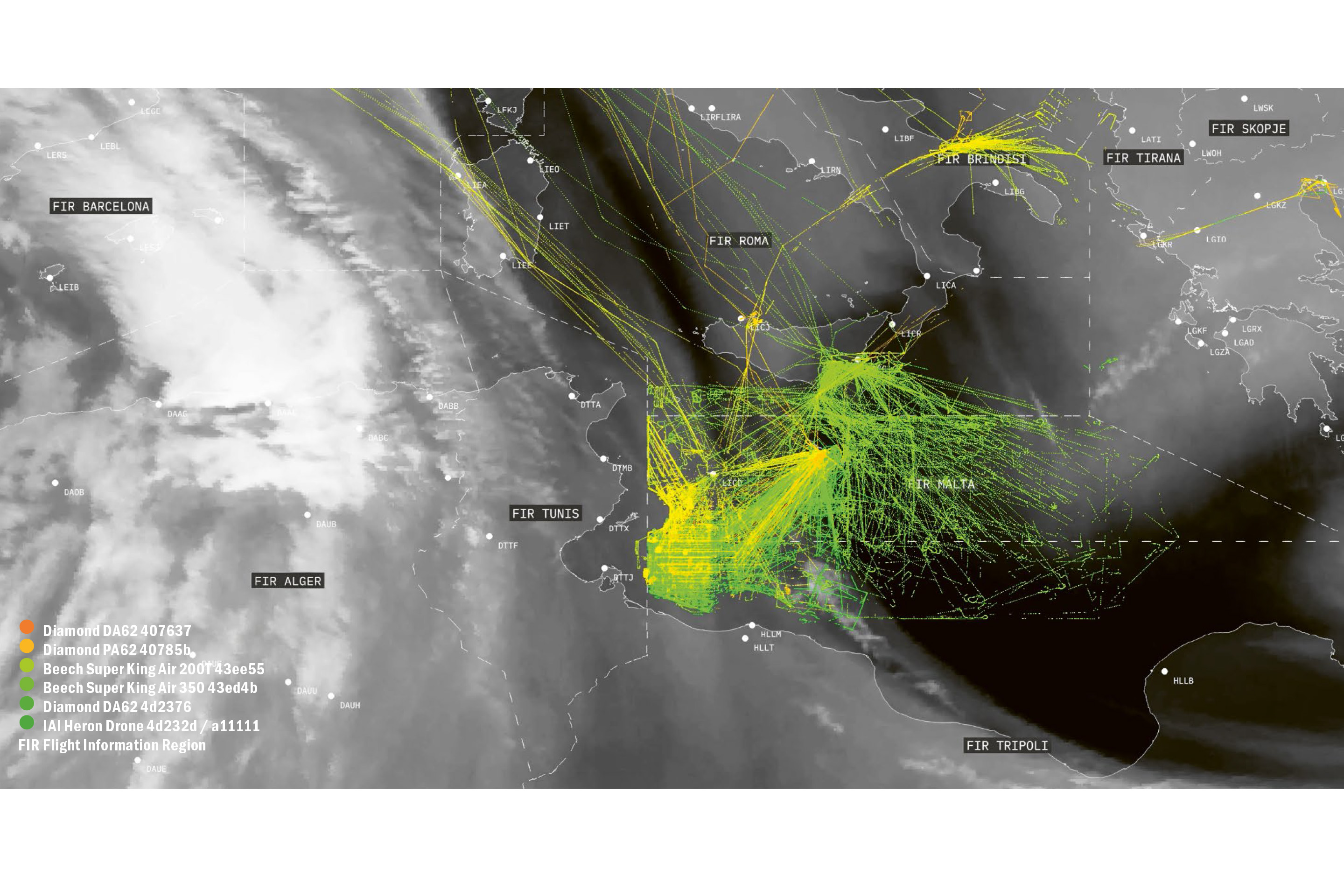
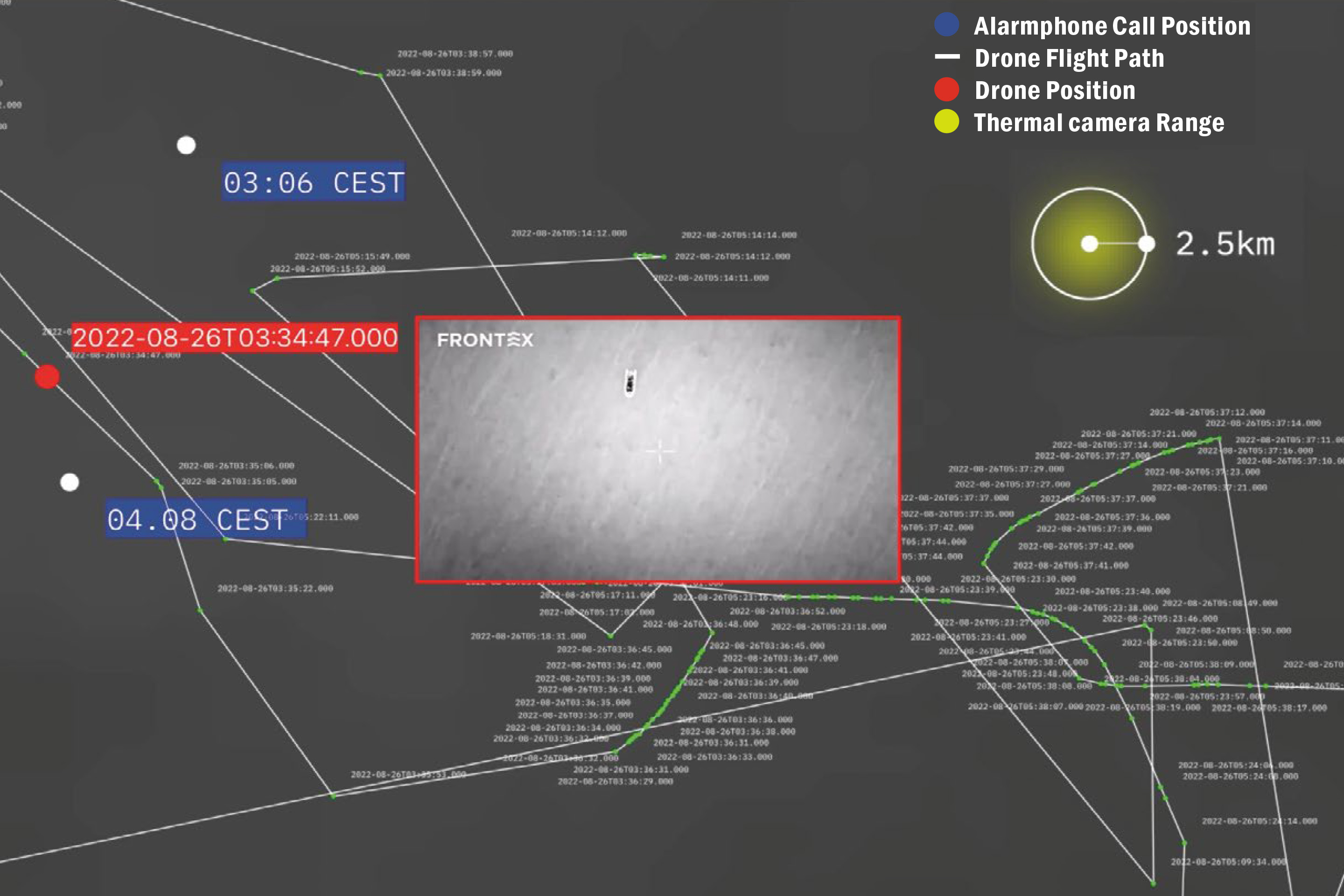
The way an investigation is conducted depends greatly on the place in which violence is produced. In an urban context, traces multiply and every device can become a source; in the Mediterranean, where LIMINAL works above all, evidence is more dispersed. As Tamimi observes, the sea is not crossed by the same density of gazes and devices that characterises a city, and reconstructing an episode of violence therefore requires a different method. The laboratory’s response is triangulation: testimonies are cross-referenced with the «geolocations we receive directly from those crossing the Mediterranean» and with highly specific digital information, such as the tracking of aircraft flying over the routes and satellite imagery. It is upon this intersection that LIMINAL builds its evidence, making the analysis of border-surveillance technologies the very form of evidence itself: movement data that, once placed in relation, reveals a violence that would otherwise remain illegible.
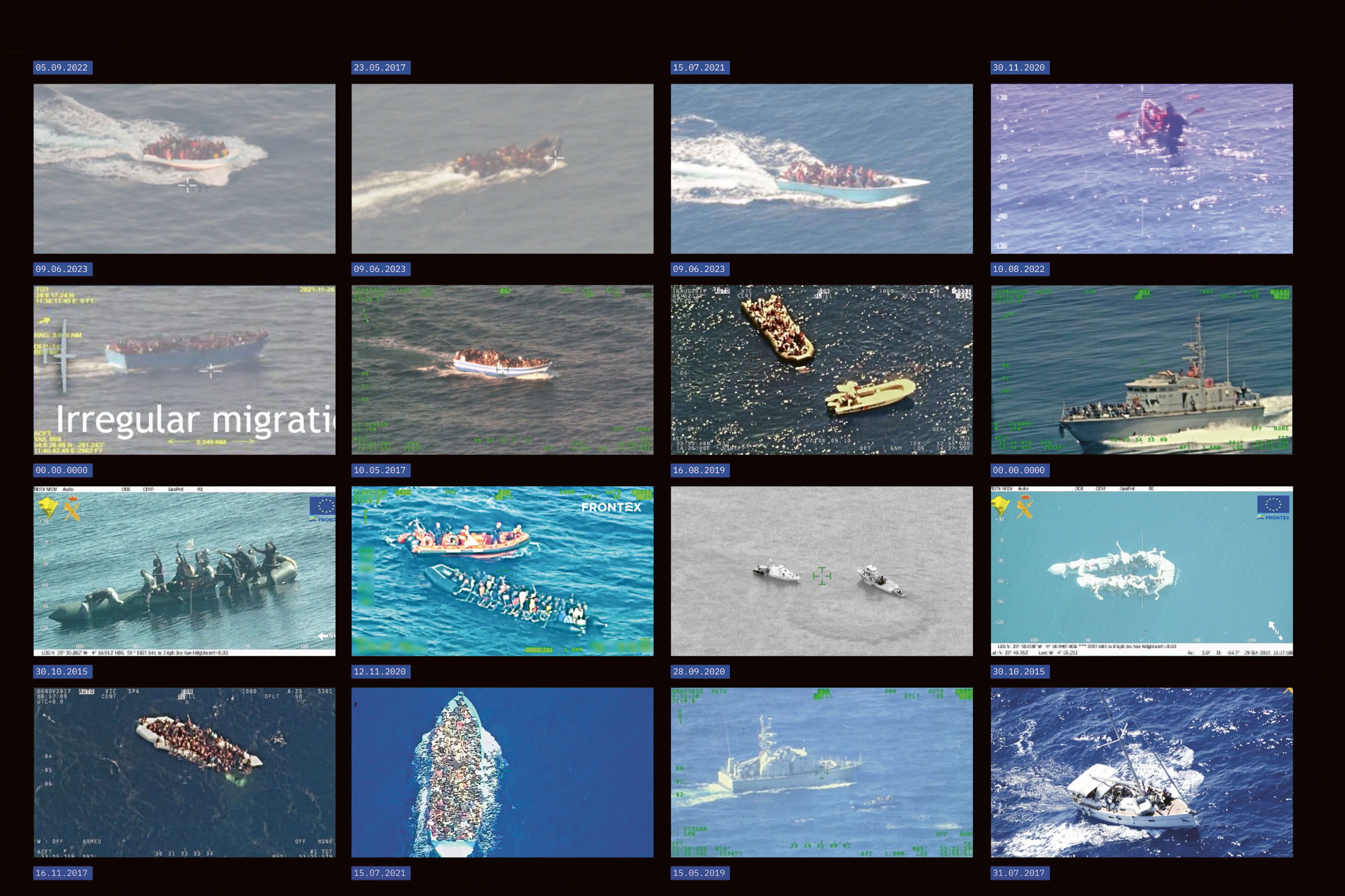
In Asymmetric Visions,4 by reconstructing through forensic and open-source methods the sensory capacities and routes of the Heron drone used by Frontex, the laboratory showed how aerial surveillance contributes to interceptions at sea. The increase in aerial presence does not correspond to an increase in rescues, as Frontex maintains, but to an increase in pushbacks. When a drone spots a boat, the information reaches the Libyan Coast Guard, which returns people to detention centres in Libya. Over time, European agencies have reduced their naval presence in favour of an aerial one, and the difference is also legal: a vessel that sights a shipwreck has a duty to rescue, while a gaze from above allows that responsibility to be evaded.
This is also one of the ways in which the Mediterranean is connected to Palestine. Many of the technologies used at Europe’s borders have a history that begins elsewhere: the same drone model that surveils the sea, a Heron manufactured by Israel Aerospace Industries, had already been used in the surveillance of bombings on Gaza. Frontex contracts its operation to private companies, and its use at the European border also increases its commercial value: marketed as battle-tested, tested in the field, the drone carries with it the history of the military uses that preceded it.5
Visibility Is Not Accountability
Ours is an age in which everything is visible, shared and accessible, and from such exposure one might expect an equally broad reaction to what is taking place. Instead, in recent years violence, spectacularised to the point of saturation, has begun to slide towards normality: in the eyes of those watching from afar, conflict and death end up appearing as the natural condition of those who undergo them, something that does not implicate the responsibility of the viewer. It is a dynamic that both collectives have observed closely, each in its own field of investigation.
In the Mediterranean studied by LIMINAL, the deaths of those attempting the crossing risk being attributed to the danger of the sea, as though the environment alone were responsible. Yet that danger also depends on how those crossings are made possible or impossible. By closing the practicable passages, the remaining routes become longer and more exposed; presenting those deaths as a natural fatality is already a way of removing them from the responsibility of a political choice. This is the mechanism that LIMINAL and, before it, Forensic Oceanography – project initiated by Lorenzo Pezzani and e Charles Heller from which the laboratory descends – have described as a normality projected onto nature: a device that disguises as the destiny of a landscape what is in fact the result of a decision.6 Forensic Architecture, whose investigations focus in particular on Gaza, observes a variant of the same phenomenon. When images of violence multiply without pause, the excess of evidence becomes almost an advantage for those who perpetrate it, because it makes violence ordinary and empties it of its weight. In this sense, as Piscitelli observes, «visibility is not directly linked to accountability».
The work of the two collectives therefore intervenes in the regime of visibility itself, transforming the indistinct flow of information into structured evidence, so that the event may become proof. The value of this operation exceeds the courts, where Forensic Architecture’s materials have also been presented. To make visible does not mean only depriving power of the instrument of denial, but also constructing an archive that resists dispersion and becomes a resource in the hands of researchers, citizens, lawyers and activists. It also recalls Judith Butler’s notion of grievability,7 according to which not all lives are considered visible, or worthy of mourning, in the same way. Some are granted the right to appear and to be grieved; for others, the same act slips into normality. It is against this disparity that the tools of spatial analysis work.
Destruction and Reconstruction, the Same Gesture
Some areas of the Sahara become impassable when these countries take on the task of detaining and repelling those on the move, a process the laboratory reconstructed in the investigation The Deportation Chain.8 By externalising borders, Tamimi observes, a space that was once «traversable» becomes «a space of violence». Forensic Architecture carries the same reasoning into Gaza. For Piscitelli, here destruction and construction proceed together: «there is no destruction without construction, no construction without destruction».
And yet, while the discussion concerns what will come after, transformation has been under way on the ground for years. New roads and new corridors appear as the agricultural north-east is razed to the ground. These are military roads, an infrastructure that accelerates precisely during ceasefires, corridors that divide the territory, such as the Netzarim Corridor cutting Gaza in two, and military stations intended to remain for years.
Reconstruction is never a neutral operation and, as Al-Shoubaki reminds us, to reconstruct is to decide who has the right to return, who has access to dwelling and services, and what future those people will be allowed to inhabit. Destruction that strikes space also strikes the social fabric of a community, not only the buildings that collapse. This is what Martin Coward has defined as urbicide.9 Reconstruction, then, can become the continuation of destruction by other means.
The reconstruction proposals circulated so far tend to overturn or normalise the current spatial order. This is the case with the plan developed by Egypt and adopted by the Arab League at the Cairo summit in March 2025, conceived as an alternative to the US proposal that envisaged the transfer of Palestinians out of Gaza. While rejecting the displacement of the population, that plan preserves the spatial devices of Israeli destruction: the buffer zone along the perimeter fence and the military corridors that fragment the territory. Forensic Architecture identified this continuity through its analysis of the masterplan.10 Removing the rubble also erases the material evidence of destruction, and it is on that evidence that the agency works.
Giving Voice to Those Who Inhabit Emergency
The three reconstruction proposals discussed in the issue – the US model, the Arab model and the one being developed at the University of Venice – all arrive from outside. Nothing originates from those who have inhabited, and will inhabit, those spaces. Tamimi links this point to an investigation that LIMINAL is conducting into the killing of journalists in Gaza, beginning from the same apparatus of aerial surveillance observed in the Mediterranean. In a territory largely closed to the international gaze, that apparatus enables targeted attacks and is directed against those who continue to document their own condition from within. To eliminate that voice is to strike at an attempt at narrative self-determination, part of a broader design of silencing. Something similar happens to those who migrate, when the same technologies, applied to the border regime, reduce the experience of people on the move to data to be intercepted.
For Tamimi, «the issue of who speaks and who decides» is «the common thread» linking the two investigations, despite their different contexts. Plans imposed from outside, he observes, aim at a fragmentation that eliminates precisely that space of social network and organisation from which a community might imagine a political future and the development of the city in which it lives; their aim is to pacify a desire for self-determination and freedom that arises from those who experience that oppression. The stakes of reconstruction, then, are not only material. The point is to give voice, through research, to those who live that condition, and no reconstruction can succeed unless it begins from those who inhabit it. For Piscitelli, «there is no reconstruction without the Palestinian voice, from beginning to end». What is at stake, ultimately, is a right: the right to narrate, map, reconstruct and imagine the future of these places.
Spaces need not correspond to the way we imagine them: they are made by the people who inhabit them. To recognise emergency as a form that produces space is to recognise that this form can be contested. «The map is not the territory»: it is a version of reality, and whoever draws the map decides which reality to make visible.
Notes
1 Korzybski, Science and Sanity.
2 «A Cartography of Genocide» is the interactive platform developed by Forensic Architecture to document Israeli military conduct in Gaza between 7.10.2023 and 16.09.2024, organising thousands of geolocated data points into overlapping layers: evacuation orders, areas of ground invasion, attacks on aid routes, and the destruction of buildings, roads, agriculture and water resources.
3 The work is accompanied by an 827-page report, Forensic Architecture, «A Spatial Analysis of the Israeli Military’s Conduct in Gaza since October 2023», which documents more than two thousand incidents and analyses their recurring patterns, including the use of evacuation orders and the expansion of buffer zones.
4 See LIMINAL, «Asymmetric Visions», an investigation conducted through forensic and open-source methods into the operational logic and sensory capacities of the Heron drone used by Frontex in the central Mediterranean. According to the research, aerial surveillance provides the Libyan coastguard with the information needed to intercept boats and return migrants to Libya.
5 Nell’estate del 2021 Frontex ha aggiunto alla propria flotta un drone Heron a pilotaggio remoto operante dall’aeroporto di Malta, costruito da Israel Aerospace Industries e gestito da una controllata di Airbus; lo stesso modello era impiegato nella sorveglianza dei bombardamenti israeliani su Gaza dal 2008 | In the summer of 2021, Frontex added to its fleet a remotely piloted Heron drone operating from Malta airport, built by Israel Aerospace Industries and managed by an Airbus subsidiary; the same model had been used in the surveillance of Israeli bombardments of Gaza since 2008.
6 The idea of the «natural» environment as a border device, lies at the heart of LIMINAL’s work and, before that, of Forensic Oceanography, a project initiated by Lorenzo Pezzani and Charles Heller in 2011 to document deaths in the Mediterranean.
7 The reference to Judith Butler’s grievability is developed in particular in Frames of War.
8 See LIMINAL, «The Deportation Chain», an investigation that reconstructs the mechanism of deportations and expulsions pushing people on the move from the Mediterranean coast into the heart of the Sahara Desert. The investigation was carried out with Refugees in Libya and the Association for Juridical Studies on Immigration.
9 Urbicidio: la distruzione deliberata dell’ambiente costruito come forma autonoma di violenza politica. Martin Coward, Urbicide | Urbicide: the deliberate destruction of the built environment as an autonomous form of political violence. Martin Coward, Urbicide.
10 In March 2025, Forensic Architecture analysed the reconstruction masterplan presented by Egypt and adopted by the Arab League at the Cairo summit, noting that it incorporates three elements of the Israeli military configuration: the buffer zone along Gaza’s perimeter; the security corridors; and the incursion roads, thirteen of which were identified by the agency.